Lough Neagh, Ireland
Date:
1601-1602
Reference:
MPF 1/133
Creator:
Maps and plans extracted to flat storage from records of the State Paper Office
Catalogue context:
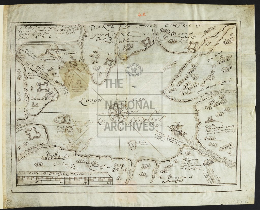
1 item extracted from SP 63/208 part 3 (48). Ireland: County Antrim: Lough Neagh. 'A description of Loughe Eaugh alias Lo. Sydneye'; map showing fortifications built by Tyrone and those held by the Governor of Knockfergus; buildings and trees in perspective. Scale: about 1 inch to 3 Irish miles. Compass star. [? Drawn by Richard Bartlett].
Categories:
Maps and plans; Overseas
Subjects:
Archives and libraries; Forestry; Ireland; Maps and plans
Topics:
Agriculture and environment; International trade and affairs; Land and buildings
Period:
Early Modern
Places:
Ireland
Copyright information:
Copyright clearance for publication is not required, except in the case of documents in third-party copyright.
Usage terms:
https://www.nationalarchives.gov.uk/documents/information-management/use-of-tna-materials.pdf