Isle of Sheppey
Date:
1572
Reference:
MPF 1/240
Creator:
Maps and plans extracted to flat storage from records of the State Paper Office
Catalogue context:
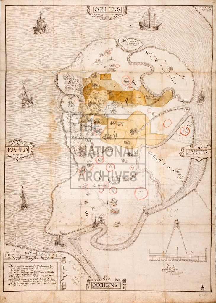
1 item extracted from SP 12/87 folio 240. 'The Plotte of Sheppey' (endorsement): map of the Isle of Sheppey, off the north Kent coast, showing houses and churches, trees, water channels, marshes and hills, windmills and beacons, Queensborough castle and town, town of Minster. Ownership of houses and lands denoted, especially that of Lord Cheney; red crayon marks encircle some of these. Some lands coloured. Also shows the North Kent coast, River Medway and Isle of Grain sketched in, with Swaleness fort drawn on a paste-down, carefully feathered-in. Seven ships, and man in boat drawn to indicate ferry to mainland. Reference notes in fretwork cartouche to anchorages and passages for ships. Plain black border. Scale bar surmounted by dividers, with legend in Latin: three inches to one mile. Cardinal points in fretwork cartouches: oriented to the east. Surveyor's monogram: 'IM'. Extracted from volume containing two surveys of Lord Cheney's possessions on Sheppey, taken in 1572, connected with the sequestration...
Categories:
Maps and plans
Subjects:
Archives and libraries; Farming; Forestry; Maps and plans; Religions
Topics:
Agriculture and environment; Land and buildings; Religion
Period:
Early Modern
Copyright information:
Copyright clearance for publication is not required, except in the case of documents in third-party copyright.
Usage terms:
https://www.nationalarchives.gov.uk/documents/information-management/use-of-tna-materials.pdf