Newcastle-upon-Tyne, Northumberland
Date:
1639
Reference:
MPF 1/287
Creator:
Maps and plans extracted to flat storage from records of the State Paper Office
Catalogue context:
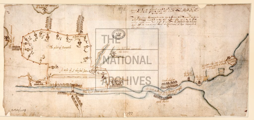
1 item extracted from SP 16/409 (item 189 (i)). Map of Newcastle-upon-Tyne, Northumberland, showing the walls, gates, bastions, armaments, windmills on hills commanding the town, and the course of the River Tyne to the sea. with notes on the siting of cannon. Scale: 1 inch to about 400 feet (town only).
Categories:
Maps and plans
Subjects:
Archives and libraries; Maps and plans; Weapons
Topics:
Military and war; Land and buildings
Period:
Early Modern
Copyright information:
Copyright clearance for publication is not required, except in the case of documents in third-party copyright.
Usage terms:
https://www.nationalarchives.gov.uk/documents/information-management/use-of-tna-materials.pdf