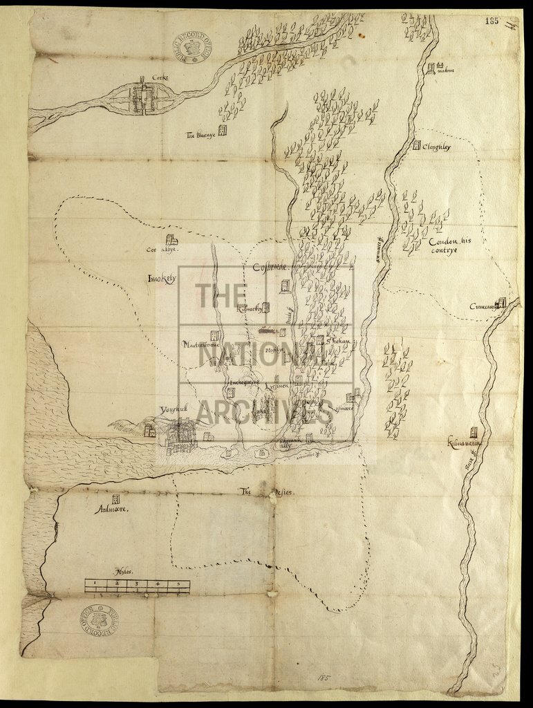
Part of Munster, Ireland
Date:
1585
Reference:
MPF 1/299
Creator:
Maps and plans extracted to flat storage from records of the State Paper Office
Catalogue context:
1 item extracted from SP 63/121 (item 52). Map of part of Munster, Ireland, (now in Counties Cork and Waterford) showing the position of Cork, Blarney Castle, Mallow Castle, Cor Abbey, Youghal, Ardmore Castle, Lismore and the baronies of the Decies with their boundary. Also shows woodland. Buildings drawn in perspective. Scale: 1 inch to about 1.5 miles.
Categories:
Maps and plans; Overseas
Subjects:
Archives and libraries; Forestry; Ireland; Maps and plans
Topics:
Agriculture and environment; International trade and affairs; Land and buildings
Period:
Early Modern
Places:
Ireland
Copyright information:
Copyright clearance for publication is not required, except in the case of documents in third-party copyright.
Usage terms:
https://www.nationalarchives.gov.uk/documents/information-management/use-of-tna-materials.pdf