South of Strabane, County Tyrone, Ireland
Date:
1586
Reference:
MPF 1/306
Creator:
Maps and plans extracted to flat storage from records of the State Paper Office
Catalogue context:
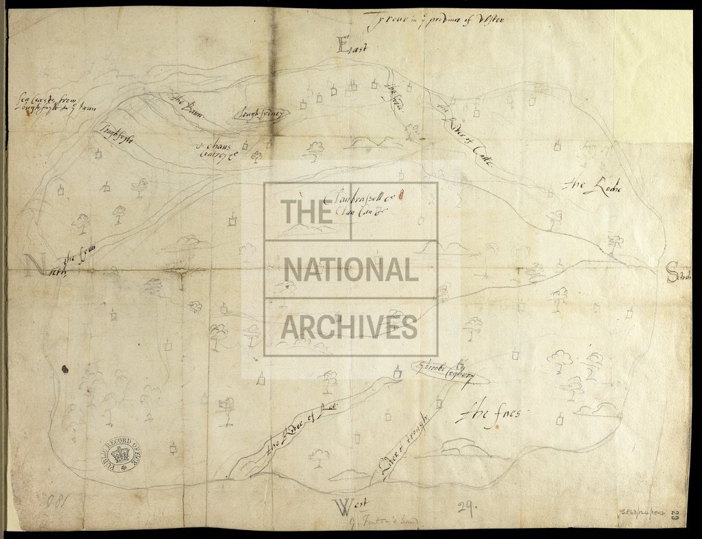
1 item extracted from SP 63/124 (item 15). Map of Tyrone in the province of Ulster, Ireland, mainly showing the area south of Strabane, but including parts of Donegal and Londonderry. Compass points indicated.
Categories:
Maps and plans; Overseas
Subjects:
Archives and libraries; Ireland; Maps and plans
Topics:
International trade and affairs; Land and buildings
Period:
Early Modern
Places:
Ireland
Copyright information:
Copyright clearance for publication is not required, except in the case of documents in third-party copyright.
Usage terms:
https://www.nationalarchives.gov.uk/documents/information-management/use-of-tna-materials.pdf