St Buryan, Cornwall
Date:
1574
Reference:
MPF 1/332
Creator:
Maps and plans extracted to flat storage from records of the State Paper Office
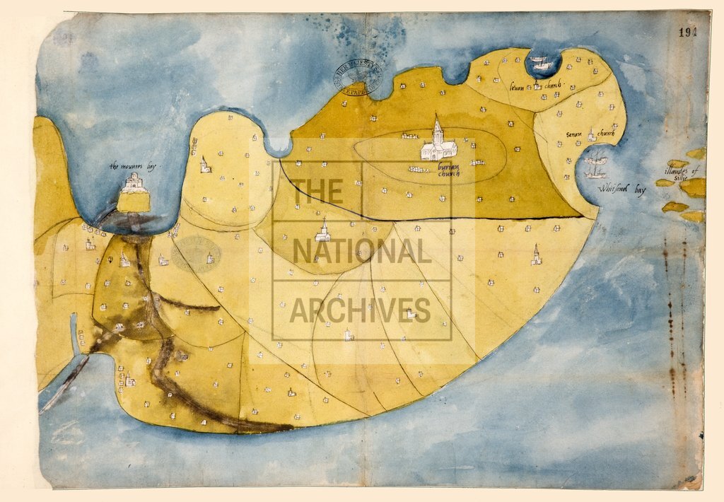
Catalogue context:
1 item extracted from SP 12/99 (item 58). Map of St Buryan, Cornwall, and adjacent parishes from Mounts Bay and St Ives Bay to Whitesand Bay and the Scilly Isles. Shows churches, houses and ships in perspective. Oriented to the south.
Categories:
Maps and plans
Subjects:
Archives and libraries; Maps and plans; Religions
Topics:
Religion; Land and buildings
Period:
Early Modern
Copyright information:
Copyright clearance for publication is not required, except in the case of documents in third-party copyright.
Usage terms:
https://www.nationalarchives.gov.uk/documents/information-management/use-of-tna-materials.pdf