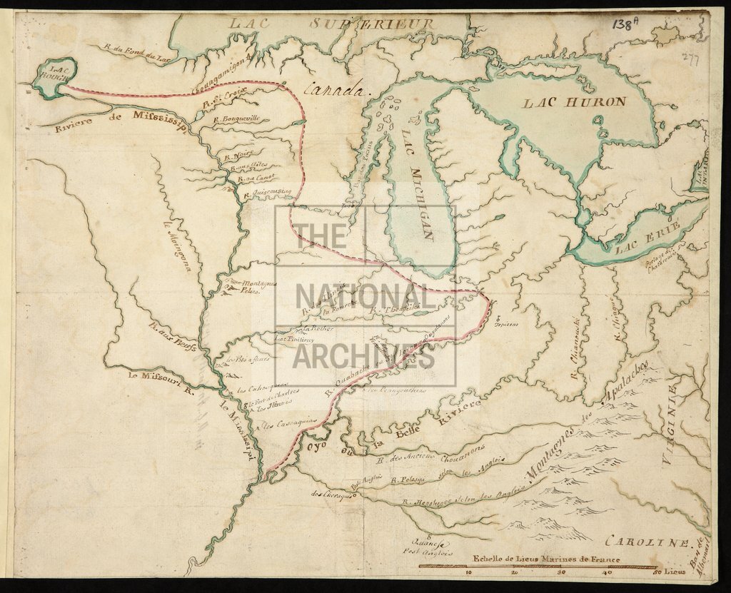
America from the Great Lakes west to the Mississippi and Missouri Rivers
Date:
1760
Reference:
MPG 1/3
Creator:
Maps and plans extracted to flat storage from records of the Colonial Office
Catalogue context:
1 item (enclosure to Major General Amherst's letter of 4 October 1760) extracted from CO 5/59 (ff 275-78). North America. Map of the country from the Great Lakes as far south as Albemarle Sound and west to the Mississippi and Missouri Rivers and Lac Rouge [Red Lake], showing place names, forts, the Canadian boundary from Red Lake to the southern end of Lake Michigan and the mouth of the Ohio. Scale: 1 inch to about 11 French marine leagues. River marked in red by the Marquis de Vaudreuil.
Categories:
Maps and plans
Subjects:
Americas; Archives and libraries; International; Maps and plans
Topics:
International trade and affairs; Land and buildings
Period:
Empire And Industry
Copyright information:
Copyright clearance for publication is not required, except in the case of documents in third-party copyright.
Usage terms:
https://www.nationalarchives.gov.uk/documents/information-management/use-of-tna-materials.pdf