America, district of Michilimackinac
Date:
1767
Reference:
MPG 1/18
Creator:
Maps and plans extracted to flat storage from records of the Colonial Office
Catalogue context:
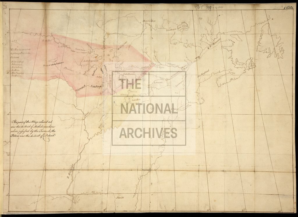
1 item extracted from CO 5/85 (ff 399, 400). North America. The continent to about 100°W. showing 'the district of Michilimackinac when preserved by the French' and 'the district of Detroit'. The map shows place-names, lakes, rivers and includes a list of forts to the westward not shown on the map. Scale: 1 inch to about 110 miles. Endorsed 'Rcd. 11th Novr. 1767 with Majr. Rogers's Mem[oria]l'. Michilimackinac includes parts of Quebec, Ontario, Manitoba, the Dakotas, Minnesota, Wisconsin, and northern Michigan; Detroit includes parts of Ohio, Indiana, southern Michigan and Ontario.
Categories:
Maps and plans
Subjects:
Americas; Archives and libraries; International; Maps and plans
Topics:
International trade and affairs; Land and buildings
Period:
Empire And Industry
Copyright information:
Copyright clearance for publication is not required, except in the case of documents in third-party copyright.
Usage terms:
https://www.nationalarchives.gov.uk/documents/information-management/use-of-tna-materials.pdf