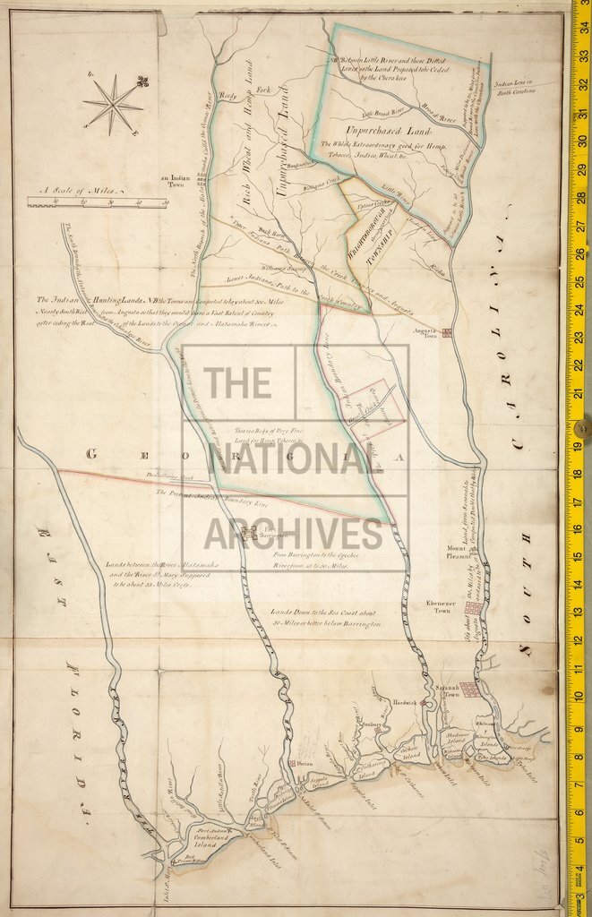
Georgia showing towns, rivers, forts, Indian boundary lines
Date:
1774
Reference:
MPG 1/20
Creator:
Maps and plans extracted to flat storage from records of the Colonial Office
Catalogue context:
1 item extracted from CO 5/661 (f 437). Map of Georgia showing towns, rivers, forts, Indian boundary lines, paths, and hunting lands. Removed from various memorials etc relating to cession of Indian lands. Scale: 1 inch to 10 miles. Compass star.
Categories:
Maps and plans
Subjects:
Archives and libraries; Europe and Russia; International; Maps and plans
Topics:
International trade and affairs; Land and buildings
Period:
Empire And Industry
Copyright information:
Copyright clearance for publication is not required, except in the case of documents in third-party copyright.
Usage terms:
https://www.nationalarchives.gov.uk/documents/information-management/use-of-tna-materials.pdf