Pennsylvania, Maryland, river systems by George Washington 1754.tif
Date:
1754
Reference:
MPG 1/118
Creator:
Maps and plans extracted to flat storage from records of the Colonial Office
Catalogue context:
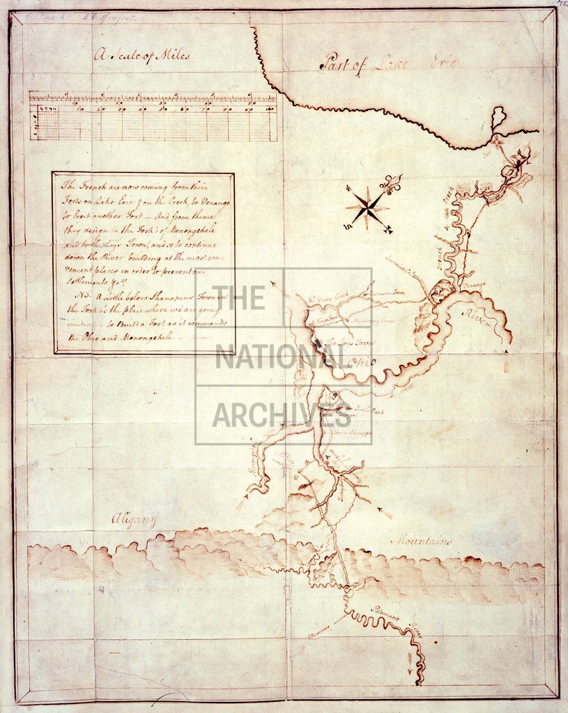
1 item (enclosure to Governor Robert Dinwiddie's letter of 29 January 1754) extracted from CO 5/14 (142). Pennsylvania, Maryland. Map of the river systems from Fort Presque Isle on Lake Erie to the Potomac River, showing French Creek, Allegheny River, the Ohio River between Pittsburgh and Great Beaver Creek, the Monongahela and the Youghiogeny Rivers. Showing place names, forts, settlements, Allegheny Mountains. A note on the map, enclosed in a square, describes the French purpose to advance from Lake Erie via French Creek to the Ohio and beyond and the British intention to build a fort at the junction of the Ohio and Monongahela. Scale: 1 inch to about 16 miles. Compass star. By George Washington.
Subjects:
Archives and libraries; International; Maps and plans
Copyright information:
Copyright clearance for publication is not required, except in the case of documents in third-party copyright.
Usage terms:
https://www.nationalarchives.gov.uk/documents/information-management/use-of-tna-materials.pdf