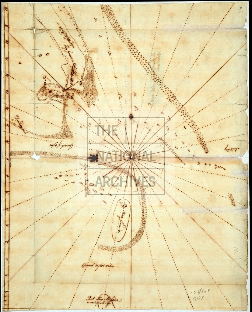
Chart of the Florida Keys
Date:
1766
Reference:
MPG 1/187/1
Creator:
Maps and plans extracted to flat storage from records of the Colonial Office
Catalogue context:
Chart of the Keys from Key West to 'Part Key Marquez or westermost Key'. Showing place names, a channel. Scale at northern border of Chart shows an unnamed unit to an inch, probably a mile or nautical mile. Compass rose and lines at centre. Originally enclosed in Governor Grant's of 26 April 1776.
Categories:
Maps and plans
Subjects:
Americas; Archives and libraries; International; Maps and plans
Topics:
International trade and affairs; Land and buildings
Period:
Empire And Industry
Copyright information:
Copyright clearance for publication is not required, except in the case of documents in third-party copyright.
Usage terms:
https://www.nationalarchives.gov.uk/documents/information-management/use-of-tna-materials.pdf