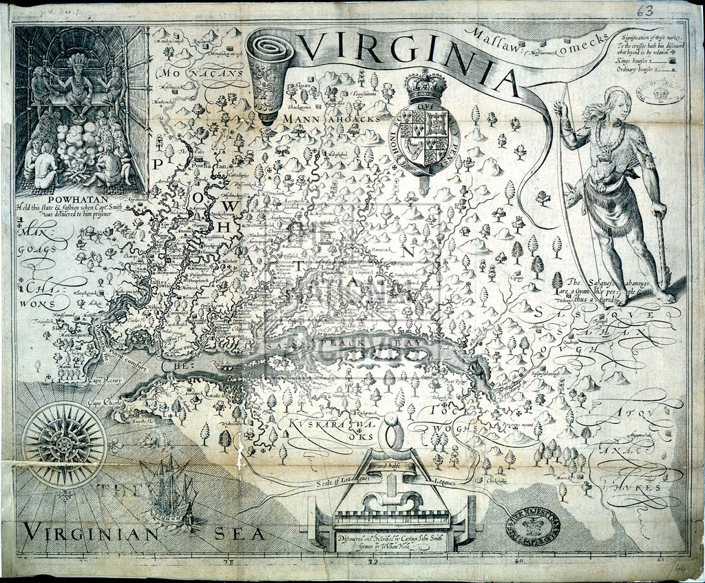
Virginia described by Captain John Smith and engraved by William Hole, [1612]
Date:
1612
Reference:
MPG 1/284
Creator:
Maps and plans extracted to flat storage from records of the Colonial Office
Catalogue context:
John Smith's map of Virginia. The map shows hills and trees in relief, the course of rivers and English and Indian names. The extent of discoveries is shown by a cross at the point reached. The map is decorated by drawings of ships and sea-animals. 1608 (Jamestown Settlement 400th anniversary)
Categories:
Maps and plans
Subjects:
Archives and libraries; Forestry; International; Maps and plans
Topics:
Agriculture and environment; International trade and affairs; Land and buildings; Military and war
Period:
Early Modern
Copyright information:
Copyright clearance for publication is not required, except in the case of documents in third-party copyright.
Usage terms:
https://www.nationalarchives.gov.uk/documents/information-management/use-of-tna-materials.pdf