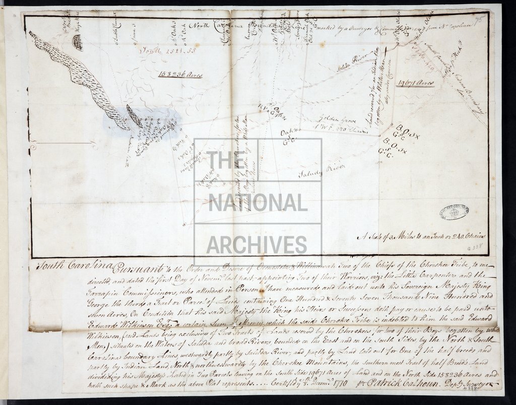
Lands on Saluda River, showing land reserved for Cherokee 'half-breeds' and lands for George III 1770.tif
Date:
1770
Reference:
MPG 1/338
Creator:
Maps and plans extracted to flat storage from records of the Colonial Office
Catalogue context:
1 item (enclosure to Mr Stuart's despatch of 8 January 1773) extracted from CO 5/74 (f 75). South Carolina. Map of lands on the Saluda River, showing two tracts of land reserved for two Cherokee 'half-breeds' and lands laid out for the King George III) for his payment of Cherokee debts due to Edward Wilkinson. Showing boundary with North Carolina and other boundaries, boundary marks, place names, acreage. Scale: 1 inch to 3 miles. Compass indicator. With the certificate (on same sheet) of Patrick Colhoun, Deputy Surveyor, 8 December 1770.
Subjects:
Americas; Archives and libraries; Debt; International; Maps and plans
Copyright information:
Copyright clearance for publication is not required, except in the case of documents in third-party copyright.
Usage terms:
https://www.nationalarchives.gov.uk/documents/information-management/use-of-tna-materials.pdf