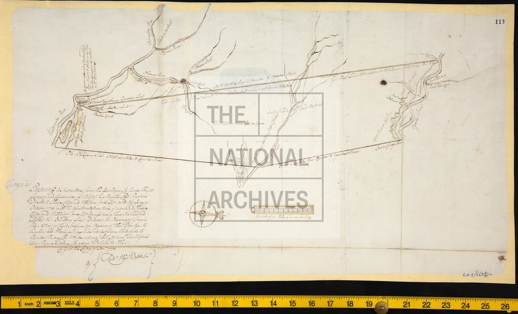
Boundary line between Georgia and the territory of the Creek Indians
Date:
1773
Reference:
MPG 1/357 (2)
Creator:
Maps and plans extracted to flat storage from records of the Colonial Office
Catalogue context:
2 items extracted from CO 5/663 (ff 45 and 113 respectively). Maps of Georgia. Detailed descriptions are given at item level.
Categories:
Maps and plans
Subjects:
Archives and libraries; Europe and Russia; International; Maps and plans
Topics:
International trade and affairs; Land and buildings
Period:
Empire And Industry
Copyright information:
Copyright clearance for publication is not required, except in the case of documents in third-party copyright.
Usage terms:
https://www.nationalarchives.gov.uk/documents/information-management/use-of-tna-materials.pdf