Virginia, Maryland, Chesapeake Bay and Potomac River [1681]
Date:
1681
Reference:
MPG 1/375
Creator:
Maps and plans extracted to flat storage from records of the Colonial Office
Catalogue context:
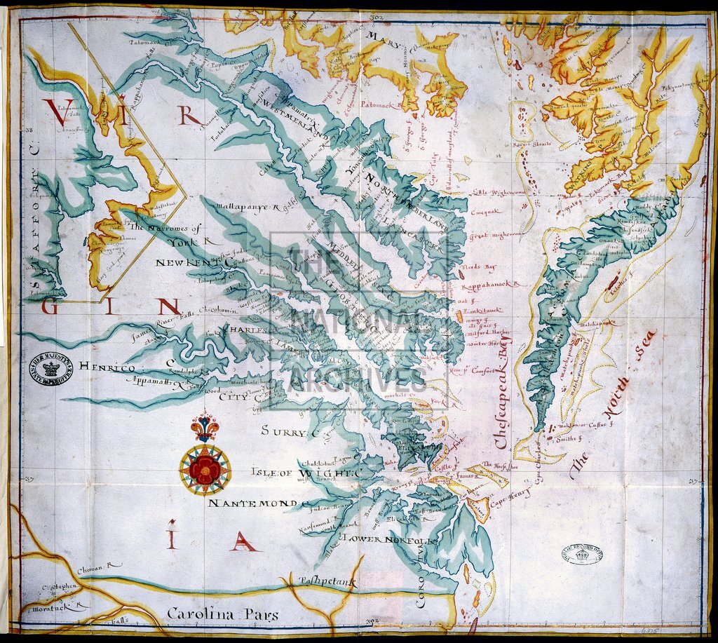
1 item extracted from CO 5/1356 . Map of the area around Chesapeake Bay and the Potomac River showing counties, place names, soundings and shoals. Virginia depicted in wide blue edging, Maryland in red and yellow. Some islands coloured or edged in gold paint. Lettering in red and black. Scale: 1 inch to about 7 miles. Compass rose in red, blue, yellow and gold. Inset extension of the map northwards to Stafford County Virginia, and Charles County Maryland, on the Potomac River.
Categories:
Maps and plans
Subjects:
Archives and libraries; International; Maps and plans
Topics:
International trade and affairs; Land and buildings
Period:
Early Modern
Copyright information:
Copyright clearance for publication is not required, except in the case of documents in third-party copyright.
Usage terms:
https://www.nationalarchives.gov.uk/documents/information-management/use-of-tna-materials.pdf