North America from Lake Huron to the Pacific
Date:
1785
Reference:
MPG 1/425
Creator:
Maps and plans extracted to flat storage from records of the Colonial Office
Catalogue context:
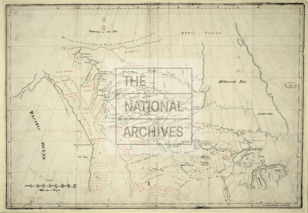
1 item (enclosure to Lieutenant Governor Hamilton's despatch of 6 June 1785) extracted from CO 42/47 (folio 665). North America. A map of the continent from Lake Huron to the Pacific, north of 40°N, showing place-names, lakes, rivers, mountains, the distribution of native American tribes, notes on country, and points reached (with dates) by individual explorers including Peter Pond and Thomas Frobisher. Scale: about 1 inch to 115 miles. The map may be based on information supplied by Peter Pond but is not his work. An earlier letter from Hamilton of 9 April 1785 (CO 42/47, folio 329) is relevant.
Categories:
Maps and plans
Subjects:
Americas; Archives and libraries; International; Maps and plans
Topics:
International trade and affairs; Land and buildings
Period:
Empire And Industry
Copyright information:
Copyright clearance for publication is not required, except in the case of documents in third-party copyright.
Usage terms:
https://www.nationalarchives.gov.uk/documents/information-management/use-of-tna-materials.pdf