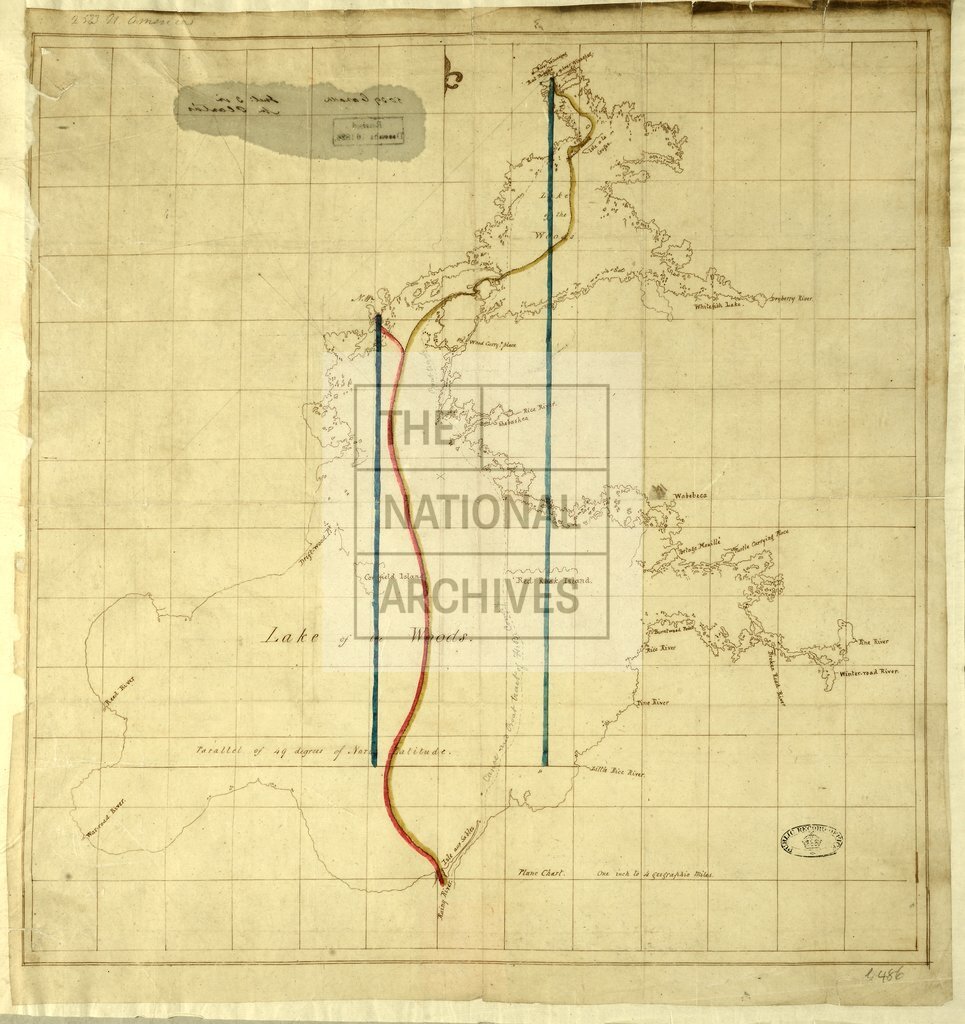
Lake of the Woods showing disputed boundary lines and place names
Date:
1824
Reference:
MPG 1/486
Creator:
Maps and plans extracted to flat storage from records of the Colonial Office
Catalogue context:
1 item (enclosure 3 to Mr Planta's letter of 14 December 1824) extracted from CO 42/201 . Canada: Ontario. Map of Lake of the Woods showing disputed boundary lines and place names. 1 inch to 4 miles. Compass indicator.
Categories:
Maps and plans
Subjects:
Americas; Archives and libraries; International; Maps and plans
Topics:
International trade and affairs; Land and buildings
Period:
Empire And Industry
Copyright information:
Copyright clearance for publication is not required, except in the case of documents in third-party copyright.
Usage terms:
https://www.nationalarchives.gov.uk/documents/information-management/use-of-tna-materials.pdf