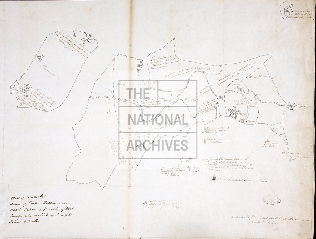
Chart of New Zealand drawn by Tooka-Titter-anue Wari-Ledo
Date:
1793
Reference:
MPG 1/532 (5)
Creator:
Maps and plans extracted to flat storage from records of the Colonial Office
Catalogue context:
5 items extracted from CO 201/9 . Pacific Ocean: (5) 'Chart of New Zealand drawn by Tooka-Titter-anue Wari-Ledo, a priest of that country who resided in Norfolk Island 6 months'. No scale shown. Originally enclosed with Lieutenant Governor King's despatch of 7 November 1793. Dimensions of sheets: 40 cm x 52.5 cm
Categories:
Maps and plans; Overseas
Subjects:
Archives and libraries; Australia and Pacific; International; Maps and plans
Topics:
International trade and affairs; Land and buildings
Period:
Empire And Industry
Places:
New Zealand
Copyright information:
Copyright clearance for publication is not required, except in the case of documents in third-party copyright.
Usage terms:
https://www.nationalarchives.gov.uk/documents/information-management/use-of-tna-materials.pdf