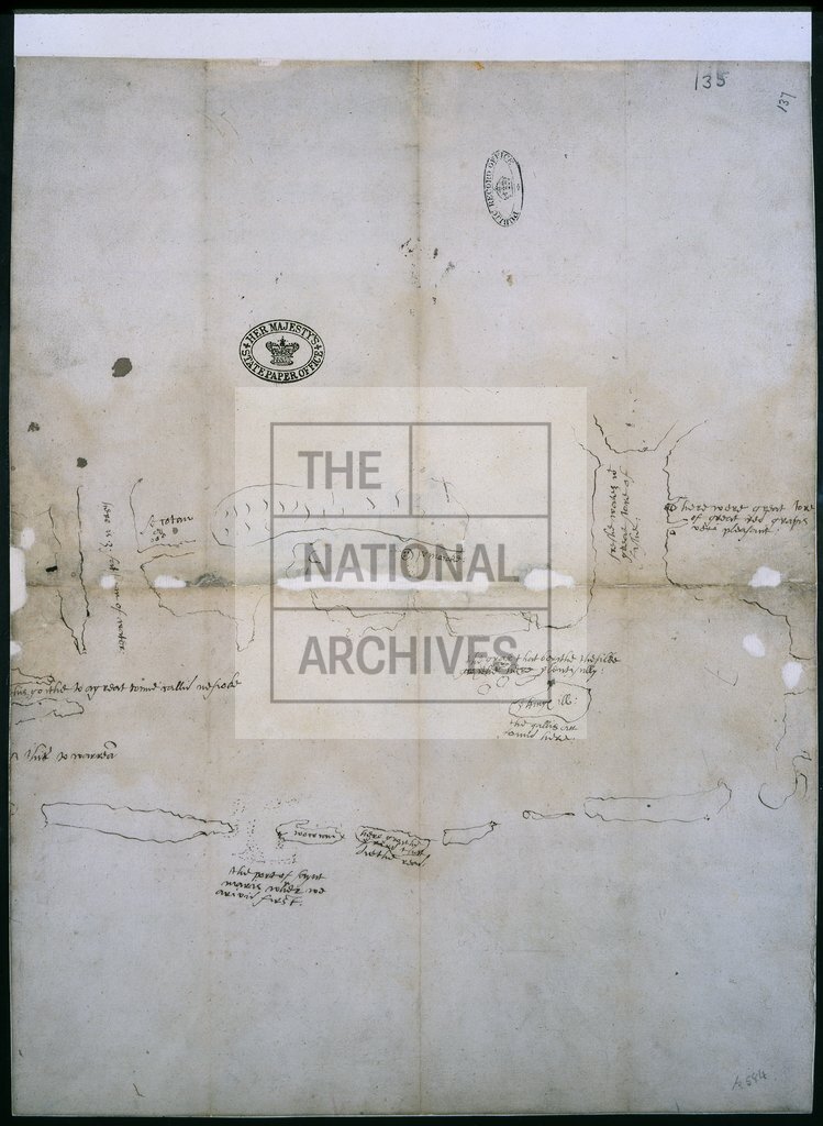
Area between Albermarle and Pamlico sounds, Mattamuskeet Lake, Roanoke Island c1585
Reference:
MPG 1/584
Creator:
Maps and plans extracted to flat storage from records of the Colonial Office
Catalogue context:
1 item extracted from CO 1/1 . North Carolina. 'A description of the land of Virginia' [endorsement]. Sketch map of the area between Albermarle and Pamlico sounds, Mattamuskeet Lake, King's (now Roanoke) Island, with unidentified islands and shoals; place-names; observations about fish and depth of water. This map was for a long time associated with a letter of Captain John Smith of 1618. It was probably sent to England early in September, 1585, on the Roebuck or the Elizabeth : it may be the map mentioned in Ralph Lane's letter to Walsingham of 8 September 1585; and if so, it is almost certainly the earliest English map of North America based on direct observation, compiled during the journeys of July-September 1585, in which Harriot and White took part. The handwriting on the map bears some resemblance to that of White, but it is not possible to assign a definite authorship. It has also been argued that the map illustrates Lane's letter of 12 August 1585, as it mentions places, sand bars and depths of w...
Categories:
Maps and plans
Topics:
Land and buildings
Period:
Early Modern
Copyright information:
Copyright clearance for publication is not required, except in the case of documents in third-party copyright.
Usage terms:
https://www.nationalarchives.gov.uk/documents/information-management/use-of-tna-materials.pdf