St Helena, Ruperts Ridge
Date:
1838
Reference:
MPG 1/635 (5)
Creator:
Maps and plans extracted to flat storage from records of the Colonial Office
Catalogue context:
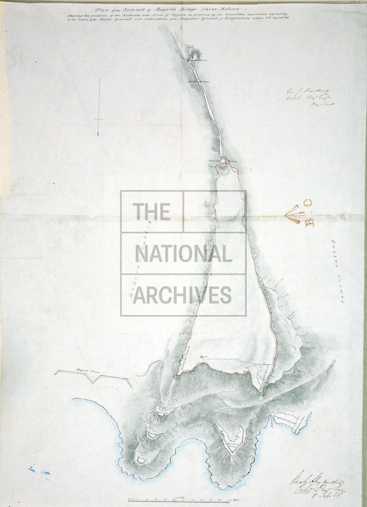
8 items extracted from CO 537/89 (folio 16). St. Helena: Jamestown and environs. (5) 'Plan of the Summit of Rupert's Ridge...shewing the position of the Batteries and Lines of Defence ...', showing alterations proposed by the Committee. Scale: 1 inch to 200 feet. Compass indicator. 75 cm x 50 cm
Categories:
Maps and plans
Subjects:
Africa; Archives and libraries; International; Maps and plans
Topics:
International trade and affairs; Land and buildings
Period:
Empire And Industry
Copyright information:
Copyright clearance for publication is not required, except in the case of documents in third-party copyright.
Usage terms:
https://www.nationalarchives.gov.uk/documents/information-management/use-of-tna-materials.pdf