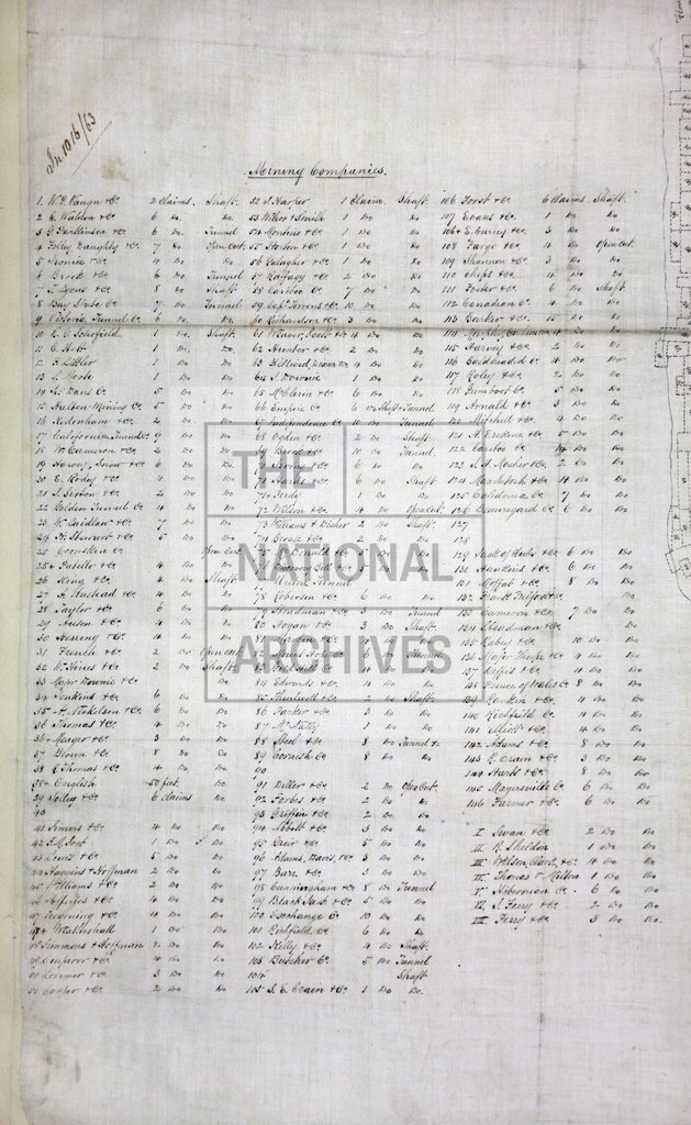
Williams Creek, Caribou, British Columbia
Date:
1862
Reference:
MPG 1/648 (4) (left half)
Creator:
Maps and plans extracted to flat storage from records of the Colonial Office
Catalogue context:
4 items extracted from CO 60/13 (folios 183, 252, 253) Detailed descriptions are given at item level.
Categories:
Maps and plans
Subjects:
Archives and libraries; International; Maps and plans
Topics:
International trade and affairs; Land and buildings
Period:
Victorians
Copyright information:
Copyright clearance for publication is not required, except in the case of documents in third-party copyright.
Usage terms:
https://www.nationalarchives.gov.uk/documents/information-management/use-of-tna-materials.pdf