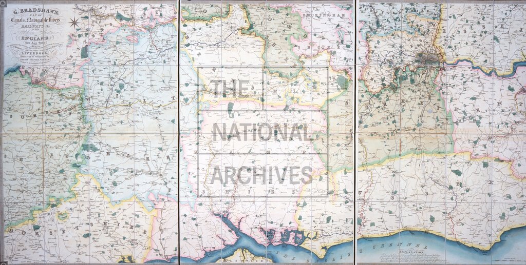
Bradshaw's map of canals, rivers and railways of southern counties of England, c1830
Date:
1830
Reference:
RAIL 1031/3
Creator:
Pre-nationalisation railway companies, pre-nationalisation canal and related companies, the London Passenger Transport Board, and successors
Catalogue context:
Bradshaw's map of canals, rivers and railways of southern counties of England. Includes Surrey Iron Railway from Wandsworth to Croydon and Croydon to Merstham Railway. Scale: 6 inches to 1 mile. From levels taken by William Johnson and Son. Published by G Bradshaw, Manchester; dedicated to Thomas Telford, President of the Institution of Civil Engineers.
Categories:
Maps and plans
Subjects:
Maps and plans; Railways; Transport management
Topics:
Land and buildings; Transport and travel
Period:
Empire And Industry
Places:
England; Great Britain
Copyright information:
The National Archives understands this item to be the copyright of the British Transport Commission and British Railways Board. It may not be reproduced except with the permission of the copyright owner. Contact details for seeking that permission can be found in the Usage terms.
Usage terms:
https://www.nationalarchives.gov.uk/documents/information-management/use-of-tna-materials.pdf