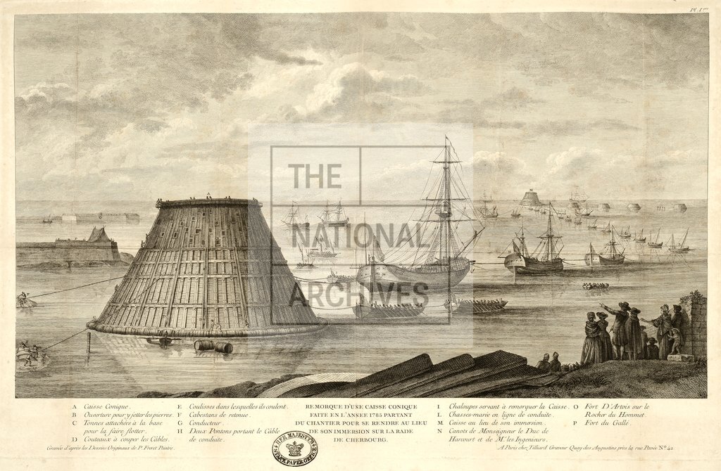
The construction of a breakwater with timber caissons, Cherbourg France
Date:
1786
Reference:
SP 112/91 (14)
Creator:
Records assembled by the State Paper Office, including papers of the Secretaries of State up to 1782
Catalogue context:
Factice atlas of 55 maps, mostly 18th century engraved maps of places in Europe and the island of Hispaniola. A manuscript list of the plates (compiled in the late 19th or early 20th century) is affixed inside the front of the volume. Detailed descriptions of the individual plates are given at item level.
Categories:
Maps and plans; Overseas
Subjects:
Caribbean; Europe and Russia; Maps and plans
Topics:
International trade and affairs; Land and buildings
Period:
Empire And Industry
Places:
France
Copyright information:
Copyright clearance for publication is not required, except in the case of documents in third-party copyright.
Usage terms:
https://www.nationalarchives.gov.uk/documents/information-management/use-of-tna-materials.pdf