Macclesfield
Date:
1835-1836
Reference:
T 72/13/39 (3)
Creator:
Records created or inherited by HM Treasury
Catalogue context:
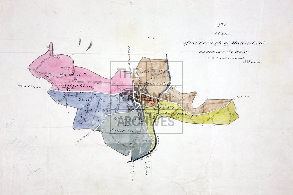
Macclesfield (Cheshire). Five maps: (i) 2 MS fair plans on 1 sheet: (a) Scale: 4 inches to 1 mile. (b) Scale: 1 inch to 1 mile. (ii) MS tracing showing wards. Scale: 1 inch to 12 chains (6.67 inches to 1 mile). (iii) MS tracing showing wards. Scale: 2 inches to 1 mile. (iv) MS tracing. Scale: 1 inch to 12 chains (6.67 inches to 1 mile). (v) Lithographed map. Scale: 4 inches to 1 mile.
Categories:
Maps and plans
Subjects:
England and Wales;
Topics:
Land and buildings
Period:
Empire And Industry
Copyright information:
Copyright clearance for publication is not required, except in the case of documents in third-party copyright.
Usage terms:
https://www.nationalarchives.gov.uk/documents/information-management/use-of-tna-materials.pdf