Europe 1700s
Date:
1700-1758
Reference:
WO 78/419 (3)
Creator:
War Office, Armed Forces, Judge Advocate General, and related bodies
Catalogue context:
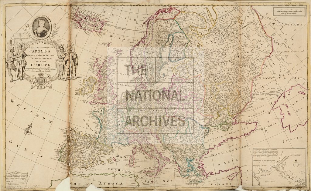
29 items, all bound into one volume: (i) Atlas of the world on 27 sheets, by Herman Moll; many, but perhaps not all, sheets were originally published as part of the set 'The World Described'. Certain features shown are inaccurate by modern standards: for instance, the fictitious Lake Chamay in south-east Asia and the depiction of California as an island. (ii) Map of the River Rhine, by Guillaume Delisle. (iii) Map of the Pembrokeshire coast, by Thomas Jeffreys. Detailed descriptions are given at item level. Many of the sheets are undated and accurate dating is often impossible or very difficult, partly because the same plates were often reused, sometimes with minor amendments, over periods of several years or decades; nevertheless, probable dates, and the reasoning behind them, are supplied whenever possible.
Categories:
Maps and plans
Subjects:
Armed Forces (General Administration); Army; Asia; Maps and plans
Topics:
International trade and affairs; Land and buildings; Military and war
Period:
Early Modern
Copyright information:
Copyright clearance for publication is not required, except in the case of documents in third-party copyright.
Usage terms:
https://www.nationalarchives.gov.uk/documents/information-management/use-of-tna-materials.pdf