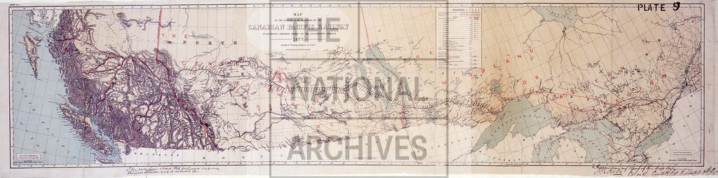
Canadian Pacific Railway. Map to accompany progress report of exploratory surveys
Date:
1877-1879
Reference:
WO 78/2311 (25)
Creator:
War Office, Armed Forces, Judge Advocate General, and related bodies
Catalogue context:
Canada. 28 items: maps, charts and drawings, mainly showing coastal areas, harbours and fortifications in Alaska, British Columbia and Vancouver Island. Detailed descriptions are given at item level. Originally illustrating a report on the defences of British Columbia by Colonel J B Lovell, Royal Engineers, 20 December 1879; this report is not filed with the drawings. The British colonies of Vancouver Island and British Columbia were united under the latter name in 1866 and the enlarged British Columbia subsequently joined the Canadian Federation on 20 July 1871. Alaska was purchased by the United States of America in 1867.
Categories:
Maps and plans; Overseas
Subjects:
Armed Forces (General Administration)
Topics:
Land and buildings; Military and war; Transport and travel
Period:
Victorians
Places:
Canada
Copyright information:
Copyright clearance for publication is not required, except in the case of documents in third-party copyright.
Usage terms:
https://www.nationalarchives.gov.uk/documents/information-management/use-of-tna-materials.pdf