Spithead, Hampshire, and approaches, from the Eastward
Date:
1848-1869
Reference:
WO 78/2316
Creator:
War Office, Armed Forces, Judge Advocate General, and related bodies
Catalogue context:
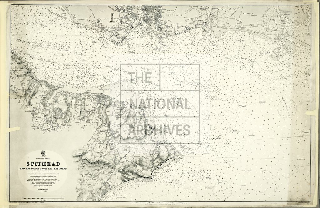
Hampshire. 'Spithead and Approaches from the Eastward': two copies of an Admiralty chart of the Solent, showing soundings in fathoms. Compass roses. Surveyed by Captain Sheringham, Royal Navy, 1848; revised to 1869 by Staff Commander D N Hal; drawn for engraving by R C Carrington; engraved by Davies, Byer and Co; published at the Admiralty, 20 April 1864. Coloured MS additions, to item (2) only, highlight defences on the Isle of Wight and at Gosport and Plymouth.
Categories:
Maps and plans
Subjects:
Armed Forces (General Administration); Army; Maps and plans; Navy
Topics:
Land and buildings; Military and war
Period:
Empire And Industry
Copyright information:
Copyright clearance for publication is not required, except in the case of documents in third-party copyright.
Usage terms:
https://www.nationalarchives.gov.uk/documents/information-management/use-of-tna-materials.pdf