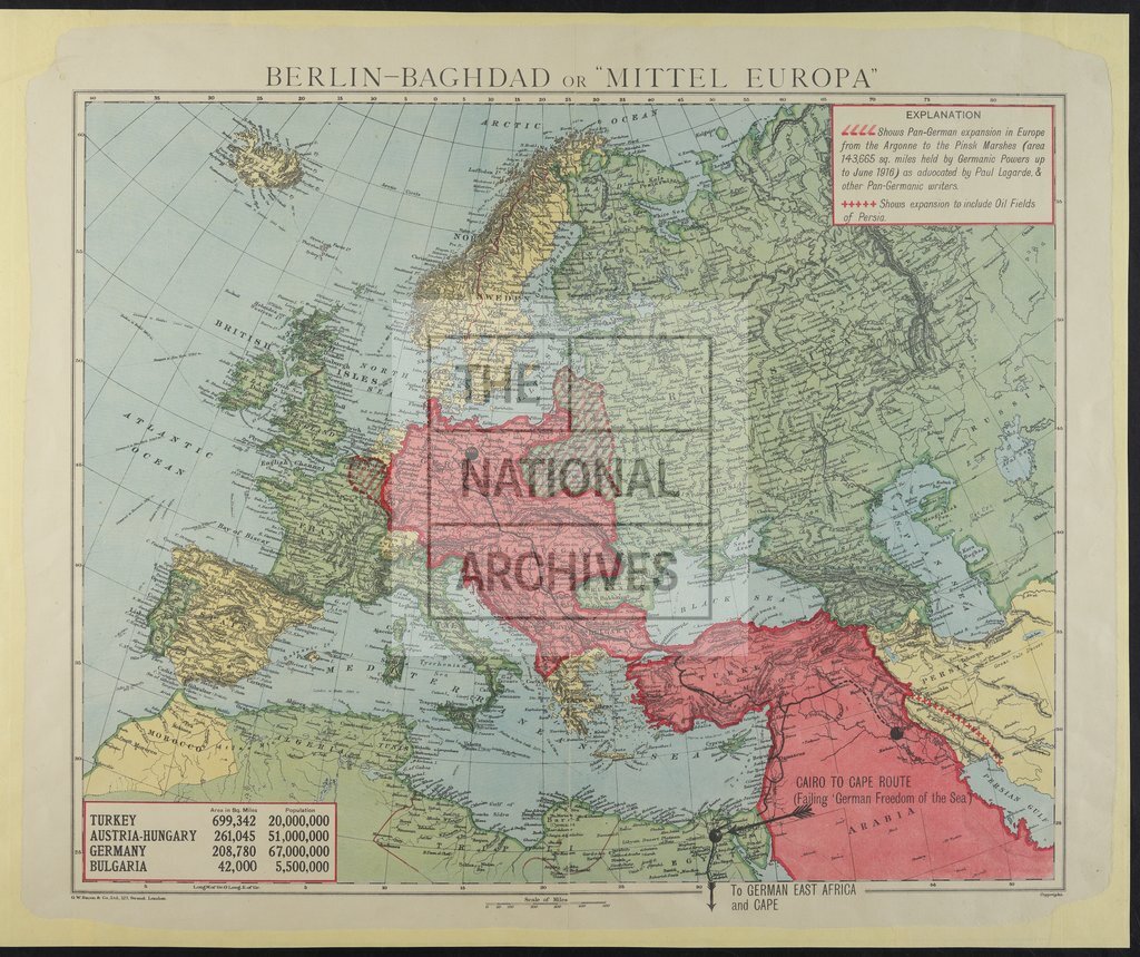
Berlin-Baghdad or 'Mittel Europa', Pan-German expansion in Europe
Date:
1916
Reference:
MPI 1/389
Creator:
Maps and plans extracted to flat storage from records of departments not assigned an individual map extract prefix
Catalogue context:
1 extract from CAB 21/77. 'Berlin-Baghdad or"Mittel Europa" '. Map of eastern Europe, North Africa and the south-west Asia, showing 'Pan-German expansion in Europe from the Argonne to the Pinsk Marshes (area 143,655 sq. miles held by Germanic Powers up to June 1916)'. The map shows the whole of the Berlin to Baghdad route and the northern part of the Arabian peninsula, with extensions into parts of France and Belgium, and the oil fields in Persia (now Iran). A note on the map points to the 'Cairo to Cape Route, failing German Freedom of the Sea'. Reference table. Scale: 1 inch to approximately 175 miles. G W Bacon & Company.
Categories:
First World War; Overseas
Subjects:
Africa; Archives and libraries; Asia; Europe and Russia; Maps and plans; Middle East; Oil and gas
Topics:
Business, finance and innovation; International trade and affairs; Land and buildings; Military and war
Period:
Early 20th Century
Places:
Germany
Copyright information:
Copyright clearance for publication is not required, except in the case of documents in third-party copyright.
Usage terms:
https://www.nationalarchives.gov.uk/documents/information-management/use-of-tna-materials.pdf