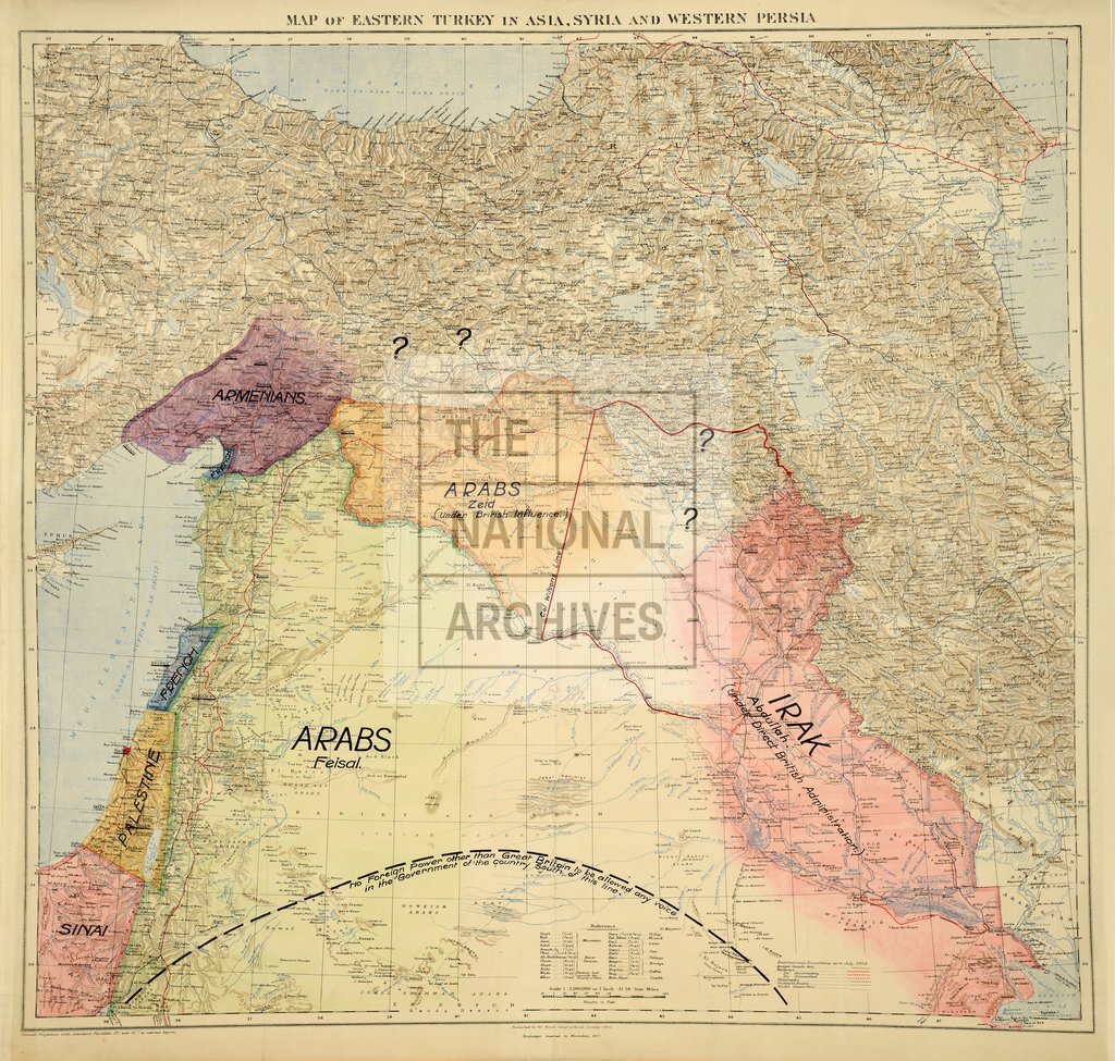
Middle East peace map presented to cabinet by T E Lawrence
Date:
1918
Reference:
MPI 1/720/1
Creator:
Maps and plans extracted to flat storage from records of departments not assigned an individual map extract prefix
Catalogue context:
Map of eastern Turkey, Syria and western Persia (now Iran) showing mountains, defiles, rivers, lakes, swamps, seas, wadis, ancient (dry) canals, towns, villages, castles, bridges, principal routes, railways, telegraphs and boundaries. Reference tables. Published by the Royal Geographical Society 1910. Railways inserted to November 1917. Originally accompanying telegrams on the subject of the defence requirements by British Element at the new frontiers. A printed note reads 'International Boundaries as in July, 1914'. Endorsed 'Lawrence's Map'. Coloured, MS additions show Protectorates and Arab states carved out of the former Ottoman Empire and indicate British and French areas of influence.
Categories:
First World War
Subjects:
Archives and libraries; Communications; Maps and plans; Middle East; Railways
Topics:
Arts and culture; British state and citizens; International trade and affairs; Land and buildings; Military and war; Transport and travel
Period:
First World War
Copyright information:
Copyright clearance for publication is not required, except in the case of documents in third-party copyright.
Usage terms:
https://www.nationalarchives.gov.uk/documents/information-management/use-of-tna-materials.pdf