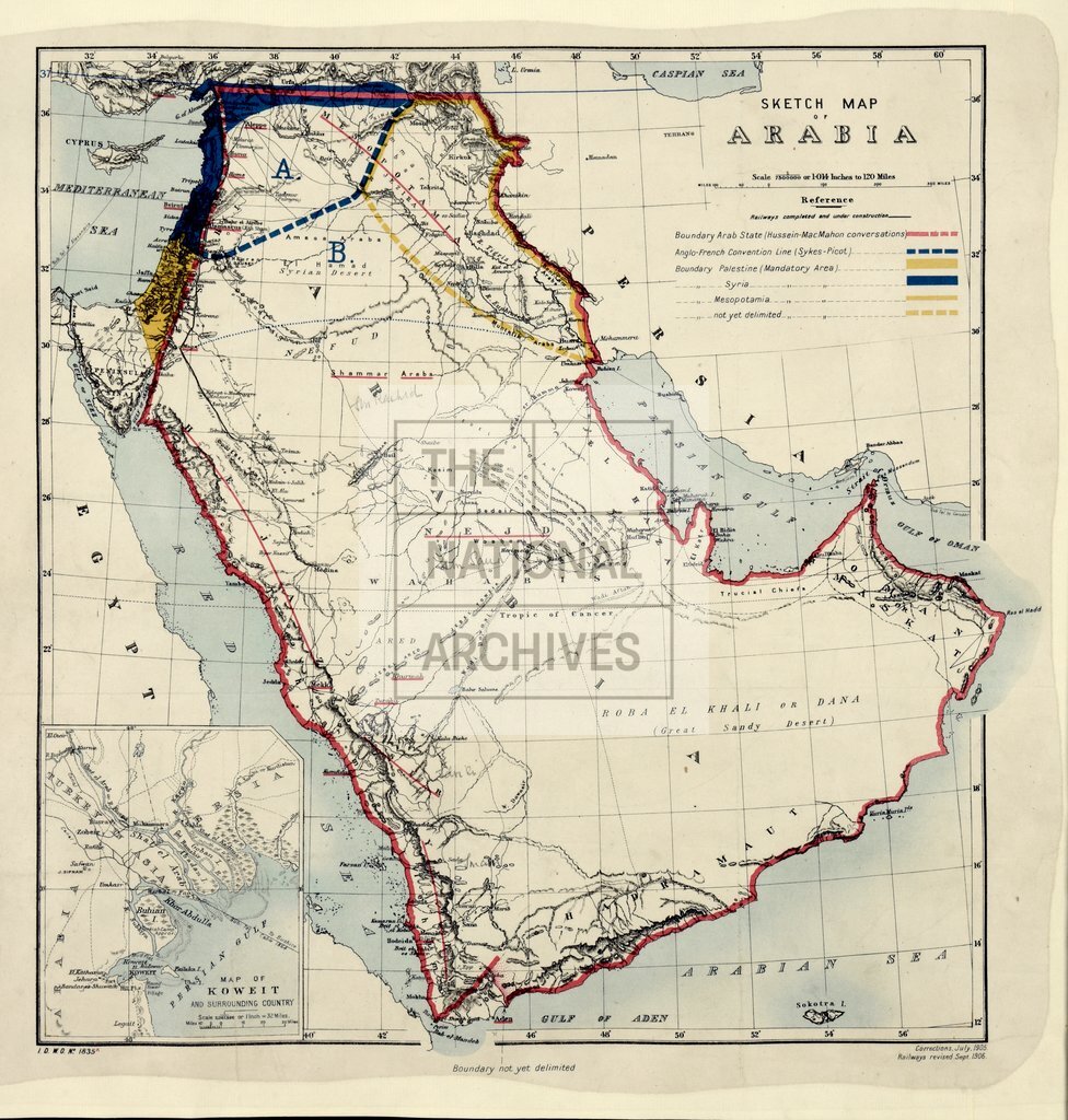
Arabia, showing areas under French and British control according to the Sykes-Picot Agreement
Date:
1916-1918
Reference:
MR 1/2014 (2)
Creator:
Maps and plans extracted to rolled storage from records of various departments
Catalogue context:
4 items: 3 maps of the Middle East showing proposed boundaries, including the Sykes-Picot line; with a cover sheet. Detailed descriptions are given at item level.
Categories:
First World War; Overseas
Subjects:
Archives and libraries; Maps and plans; Middle East
Topics:
International trade and affairs; Land and buildings; Military and war
Period:
Early 20th Century
Places:
France
Copyright information:
Copyright clearance for publication is not required, except in the case of documents in third-party copyright.
Usage terms:
https://www.nationalarchives.gov.uk/documents/information-management/use-of-tna-materials.pdf