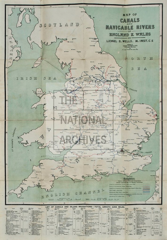
Map of canals and navigable rivers of England and Wales, c1910
Date:
1910
Reference:
RAIL 1029/56
Creator:
Pre-nationalisation railway companies, pre-nationalisation canal and related companies, the London Passenger Transport Board, and successors
Catalogue context:
'Map of Canals and Navigable Rivers of England and Wales': showing railway-owned and independent properties, and distinguishing between canals able to accommodate narrow boats, large or small barges, vessels needing 6 feet and draught and sea going vessels, and canals abandoned or converted into railways. Reference table to the lengths of waterways (130 undertakings with 3948 miles of canal in total). Scale: 1 inch to about 18 miles. Degrees latitude and longitude in margins. By Lionel B Wells, Member of the Institution of Civil Engineers; lithographed by George Falkner & Sons, 170 Deansgate, Manchester, and 181 Queen Victoria Street, London. Annotated in pencil.
Categories:
Transport and travel
Subjects:
Maps and plans; Railways; Transport management
Topics:
Land and buildings; Transport and travel
Period:
Early 20th Century
Places:
England; Great Britain; Wales
Copyright information:
The National Archives understands this item to be the copyright of the British Transport Commission and British Railways Board. It may not be reproduced except with the permission of the copyright owner. Contact details for seeking that permission can be found in the Usage terms.
Usage terms:
https://www.nationalarchives.gov.uk/documents/information-management/use-of-tna-materials.pdf