Britain's railways, grouped as originally proposed by the Mo T for Railways Act
Date:
1921
Reference:
RAIL 1031/69
Creator:
Pre-nationalisation railway companies, pre-nationalisation canal and related companies, the London Passenger Transport Board, and successors
Catalogue context:
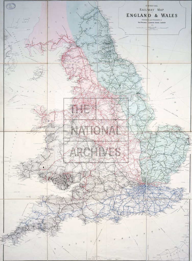
'Official Railway Map of England & Wales Prepared and Published by the Railway Clearing House'. Shows the lines and territories to be allocated to the 'Big Four' railway companies post consolidation, coloured to define the grouping as originally proposed by the Ministry of Transport for the Railways Act 1921. Scale: 4 inches to 45 miles. Drawn and engraved by J and W Emslie; lithographed by McCorquodale & Co; published by the Railway Clearing House, 123 Seymour Street, Euston Square.
Categories:
Transport and travel
Subjects:
Maps and plans; Railways; Transport management
Topics:
Land and buildings; Transport and travel
Period:
Interwar
Places:
Great Britain
Copyright information:
The National Archives understands this item to be the copyright of the British Transport Commission and British Railways Board. It may not be reproduced except with the permission of the copyright owner. Contact details for seeking that permission can be found in the Usage terms.
Usage terms:
https://www.nationalarchives.gov.uk/documents/information-management/use-of-tna-materials.pdf