Plan of advanced Turkish trenches, Gallipoli campaign
Date:
1915
Reference:
WO 317/13 (9)
Creator:
War Office, Armed Forces, Judge Advocate General, and related bodies
Catalogue context:
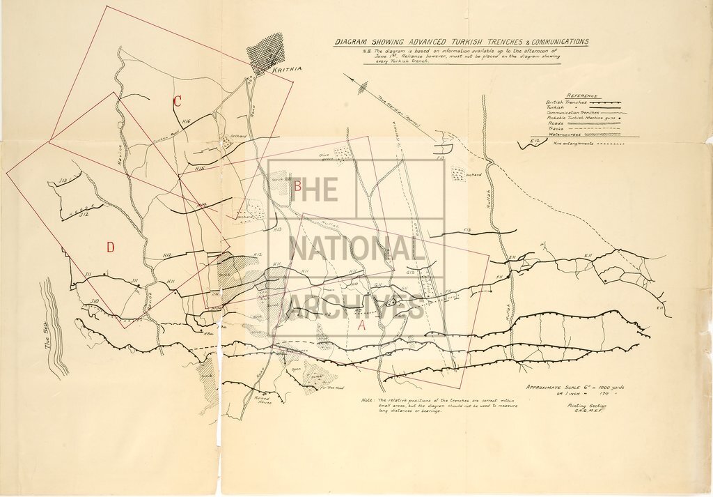
Gallipoli 1915. Mapping from Aeroplane Photos. 'Notes on mapping from aeroplane photographs in the Gallipoli Peninsula'. Mapping from Aeroplane Photographs in Gallipoli (10 pages). Later addenda. Provision of Control (3 pages). Appendix I. Some individual points worthy of further consideration (6 pages). Appendix II. A consideration of various sources of error (11 pages). List of photographs and plans included in the document (these are numbered as they appear on the document/s): 1) 4 vertical aerial photographs individually marked A, B, C, and D. (12cm x 17cm). 2) Appendix II - Figures. 3) Part of map of Gallipoli Peninsula with plot of aerial photographs A, B, C, and D. 'GALLIPOLI 1' hand stamp on reverse. 4) Part of map of Gallipoli Peninsula with plot of aerial photographs A, B, C, and D. 5) Diagram showing advanced Turkish trenches and communications based on information available up to the afternoon 1 June 1915 with plot of aerial photographs A, B, C, and D. Scale approximately 6 inches = 1,000 yard...
Categories:
First World War; Overseas
Subjects:
Armed Forces (General Administration); Army; Maps and plans; Operations, battles and campaigns
Topics:
Land and buildings; Military and war
Period:
Early 20th Century
Copyright information:
Copyright clearance for publication is not required, except in the case of documents in third-party copyright.
Usage terms:
https://www.nationalarchives.gov.uk/documents/information-management/use-of-tna-materials.pdf