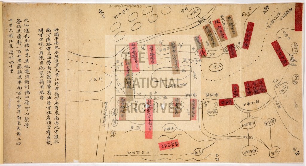
Positions of government and rebel troops, at Ta-huang-chiang hsu, between P'ing-nan and Kuei-p'ing on the Hsi-chiang (West River) in Kwangsi, China 1850s
Date:
1850-1859
Reference:
FO 931/1115
Creator:
Foreign Office
Catalogue context:
A military map (with notes) showing the positions of government and rebel troops, boats, and military installations at Ta-huang-chiang hsü, a point between P'ing-nan and Kuei-p'ing on the Hsi-chiang (West River) in Kwangsi.
Categories:
Maps and plans; Overseas
Subjects:
Conflict; International; Maps and plans; Operations, battles and campaigns; Treason and rebellion
Topics:
British state and citizens; International trade and affairs; Land and buildings; Military and war
Period:
Victorians
Places:
China
Copyright information:
Copyright clearance for publication is not required, except in the case of documents in third-party copyright.
Usage terms:
https://www.nationalarchives.gov.uk/documents/information-management/use-of-tna-materials.pdf