Situation of Native American nations between South Carolina and the Mississippi River, c1725.tif
Date:
c1725
Reference:
CO 700/NORTHAMERICANCOLONIESGENERAL6 (2)
Creator:
Records of the Colonial Office, Commonwealth and Foreign and Commonwealth Offices, Empire Marketing Board, and related bodies
Catalogue context:
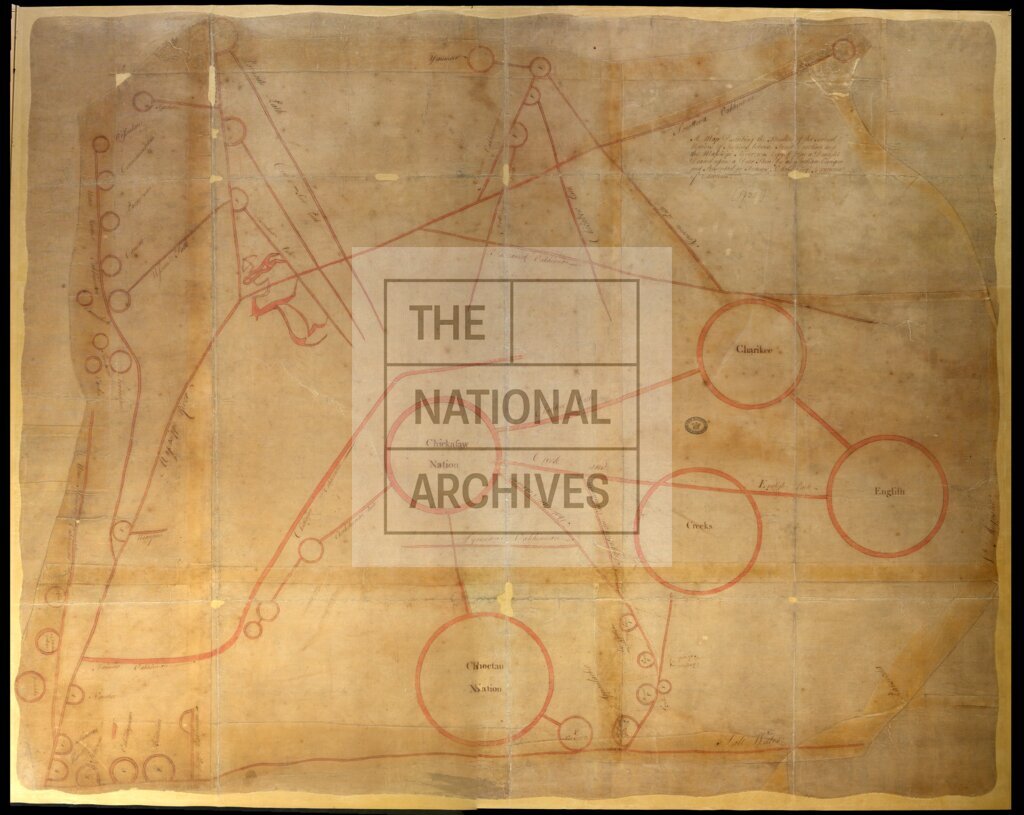
'A Map Describing the Situation of the several Nations of Indians between South Carolina and the Massisipi River; was Copyed from a Draught Drawn upon a Deer Skin by an Indian Cacique and Presented to Francis Nicholson Esqr., Governour of Carolina': map similar to CO 700/NorthAmericanColoniesGeneral/6/1 but somewhat different in appearance, and in the naming and placing of nations or tribes. The area covered extends beyond the Mississippi River, including the Alabama and Mississippi state region. An area of 'Salt Water' is shown. Drawing of a Native American holding a bow and leading a horse. Not to scale.
Subjects:
Americas; International; Maps and plans
Copyright information:
Copyright clearance for publication is not required, except in the case of documents in third-party copyright.
Usage terms:
https://www.nationalarchives.gov.uk/documents/information-management/use-of-tna-materials.pdf