Lighthouse, Needham's Point, Barbados
Date:
1835
Reference:
MPD 1/8 (2)
Creator:
Maps and plans extracted to flat storage from records of the Treasury and Treasury Solicitor
Catalogue context:
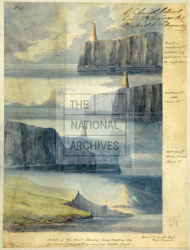
Barbados. 5 sheets. (1) Elevation of a lighthouse proposed to be erected on the windward side of the Island. Scale: 1 inch to 10 ft. (2) Views of coastline including Needham Point on which it is proposed to erect the lighthouse. (3) Section of the lighthouse. Scale: 1 inch to about 6 ft. (4) Panoramic Sketch of the windward side of the Island. (5) Map of coast from Bridgetown to Consets Bay, showing proposed site of lighthouse at Needham Point, and places of wrecks from 1827 to 1834. Reference table to wrecks. Compass indicator. All drawn by Lieutenant Leicester V Smith, RE, 18 May 1835, and signed by C F Smith, Colonel Commanding RE, 31 August 1835. Dimensions of sheets: (1) 36.6 cm x 27.2 cm; (2) 7.6 cm x 28.4 cm; (3) 60.2 cm x 47.5 cm; (4) 14.7 cm x 202.2 cm; (5) 74.2 cm x 96.5 cm.
Categories:
Buildings and architecture
Subjects:
Archives and libraries; Caribbean; Maps and plans
Topics:
Land and buildings; International trade and affairs
Period:
Empire And Industry
Copyright information:
Copyright clearance for publication is not required, except in the case of documents in third-party copyright.
Usage terms:
https://www.nationalarchives.gov.uk/documents/information-management/use-of-tna-materials.pdf