Kowloon Peninsula
Date:
1860
Reference:
MPG 1/159
Creator:
Maps and plans extracted to flat storage from records of the Colonial Office
Catalogue context:
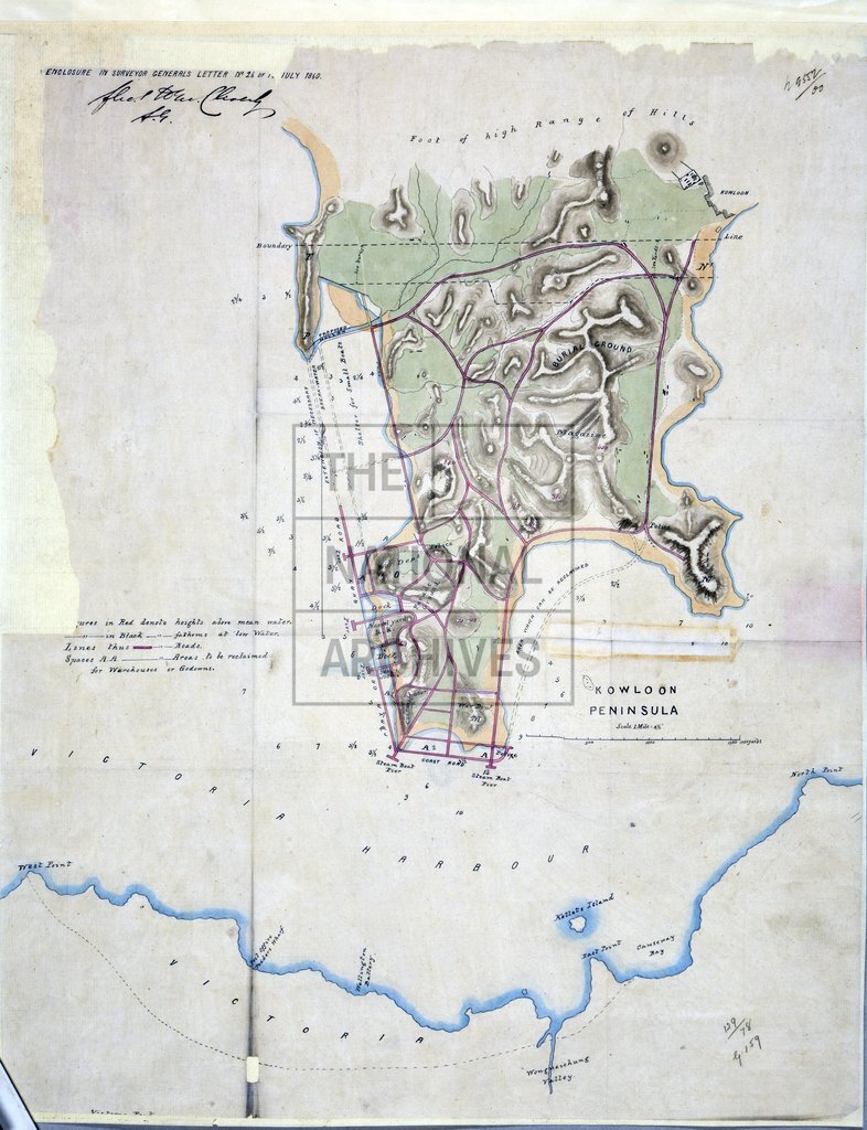
1 item extracted from CO 129/78 (report 26). Map of the Kowloon Peninsula, Hong Kong, showing roads, docks and areas under the sea for reclamation. Scale: 1 inch to about 400 yards.
Categories:
Buildings and architecture
Subjects:
Archives and libraries; Asia; International; Maps and plans
Topics:
Land and buildings; International trade and affairs
Period:
Victorians
Copyright information:
Copyright clearance for publication is not required, except in the case of documents in third-party copyright.
Usage terms:
https://www.nationalarchives.gov.uk/documents/information-management/use-of-tna-materials.pdf