Scarborough Castle Barrack Atlas Plan
Date:
1879-1913
Reference:
MPHH 1/364
Creator:
Maps and plans extracted to extra large flat storage from records of the War Office
Catalogue context:
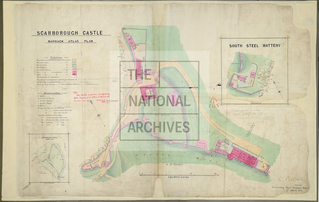
Yorkshire, North Riding. (1) 'Scarborough Castle Barrack Atlas Plan'. Tables of reference and accommodation. Scale: 1 inch to 30 feet. Compass indicator. By N R Yeomans. Signed Colonel E Belfield, Commanding RE North District, 5 March 1879. Insets: Location plan; South Steel Battery; scales: 12 inches to 1 mile and 1 inch to 30 feet respectively. MS additions and note dated 1913. (2) Zincographed version of (1); printed at the School of Military Engineering, Chatham, 1879.
Categories:
Buildings and architecture
Subjects:
Archives and libraries; Armed Forces (General Administration); Army; Maps and plans
Topics:
Land and buildings; Military and war
Period:
Victorians
Copyright information:
Copyright clearance for publication is not required, except in the case of documents in third-party copyright.
Usage terms:
https://www.nationalarchives.gov.uk/documents/information-management/use-of-tna-materials.pdf