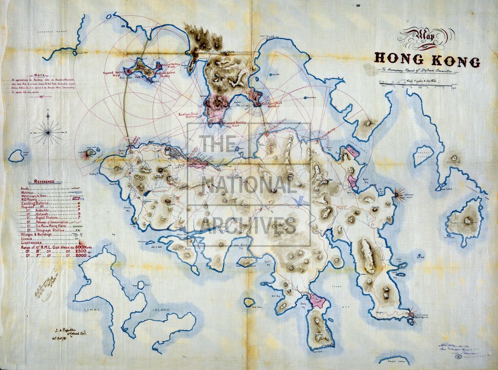
Map of Hong Kong to Accompany Report of Defence Committee
Date:
1881
Reference:
MRQ 1/49
Creator:
Maps and plans extracted to rolled storage from records of various departments held at the Public Record Office, Kew
Catalogue context:
1 item (originally enclosed, with a report of the [Hong Kong] Defence Committee, in a despatch from Governor Pope Hennessey, 21 February 1882) extracted from CO 129/197 . 'Map of Hong Kong To Accompany Report of Defence Committee': covering Hong Kong Island, Stonecutters Island and the Kowloon Peninsula, showing existing and proposed defences and the location and extent of War Department property; also showing the terrain (including spot heights), waterways, roads, the water supply to [Victoria] town, and the boundary between British territory and Chinese territory. Reference table and note. Scale: 4 inches to 1 mile. Compass indicator. Signed: Sergeant H H Hinderer, Royal Engineers, Military Draughtsman, 13 October 1881; Lieutenant Colonel J A Papillon, Commanding Royal Engineers, 14 October 1881; and Baronet Colonel L F Hall, Commanding Royal Artillery, China and South Seas, President of the Defence Committee.
Categories:
Buildings and architecture; Overseas
Subjects:
Archives and libraries; Armed Forces (General Administration); Army; Asia; Maps and plans; Operations, battles and campaigns; Resources
Topics:
Agriculture and environment; International trade and affairs; Land and buildings; Military and war
Period:
Victorians
Places:
Hong Kong
Copyright information:
Copyright clearance for publication is not required, except in the case of documents in third-party copyright.
Usage terms:
https://www.nationalarchives.gov.uk/documents/information-management/use-of-tna-materials.pdf