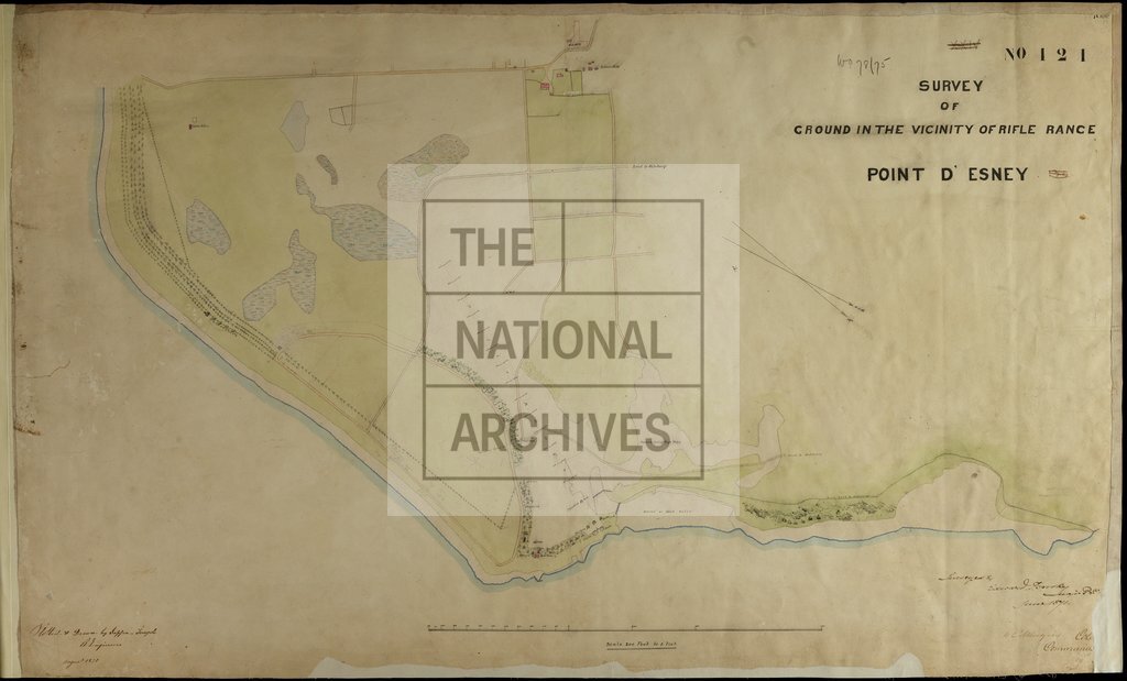
Survey of ground in the vicinity of rifle range, Pointe d'Esny, Mauritius
Date:
1871-1875
Reference:
WO 78/75
Creator:
War Office, Armed Forces, Judge Advocate General, and related bodies
Catalogue context:
Mauritius: Pointe d'Esny. 'Survey of Ground in the Vicinity of Rifle Range. Point d'Esney [sic]'. Scale: 1 inch to 200 feet. Compass indicator. Surveyed by Major Edward T Brooke, Royal Engineers, June 1871; plotted and drawn by Sapper [I] Temple, Royal Engineers, Aug 1871; signed by Colonel W C Menzies, 19 April 1872. Stamped at the Royal Engineers' Office, Mauritius, 14 June 1875.
Categories:
Buildings and architecture
Subjects:
Africa; Armed Forces (General Administration); Army; Maps and plans; Weapons
Topics:
International trade and affairs; Land and buildings; Military and war
Period:
Victorians
Copyright information:
Copyright clearance for publication is not required, except in the case of documents in third-party copyright.
Usage terms:
https://www.nationalarchives.gov.uk/documents/information-management/use-of-tna-materials.pdf